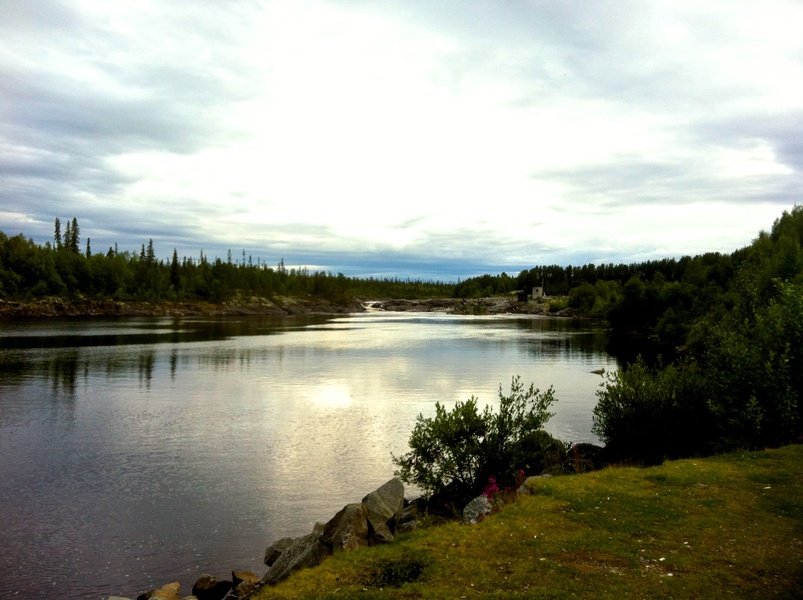
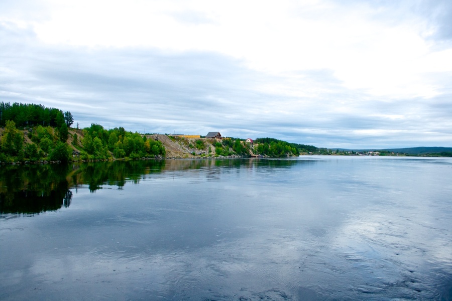
The Tuloma River
Lvov V. L.
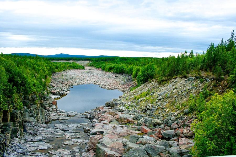
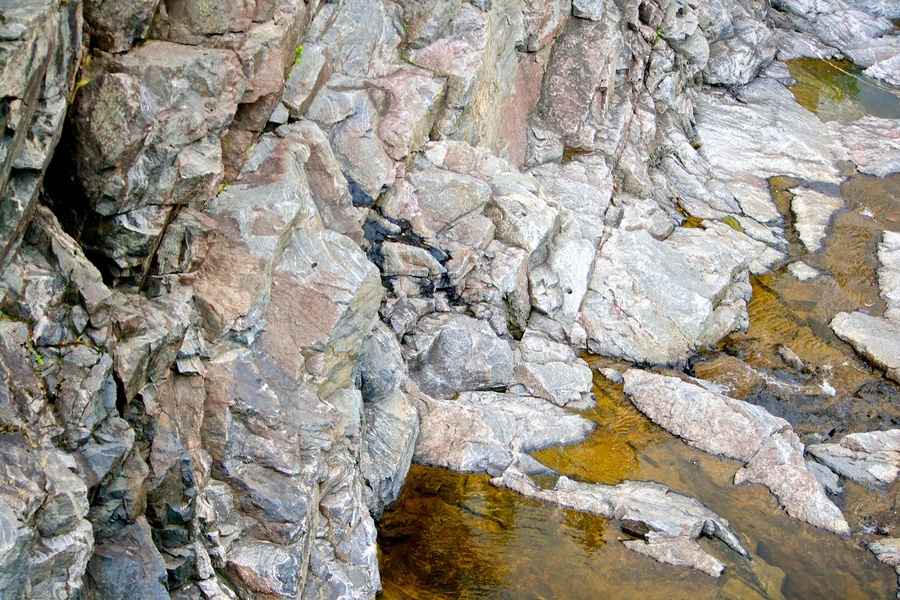
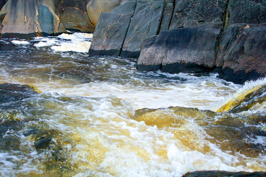
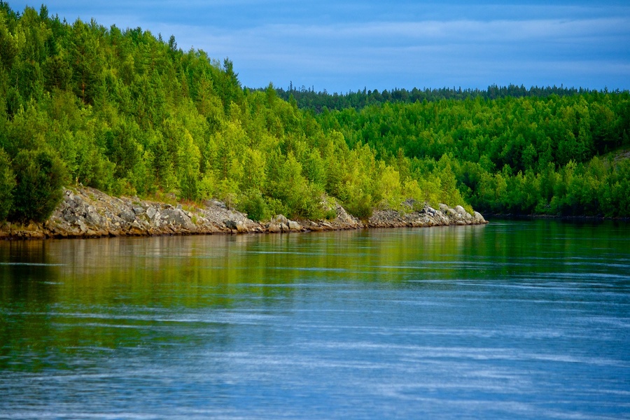
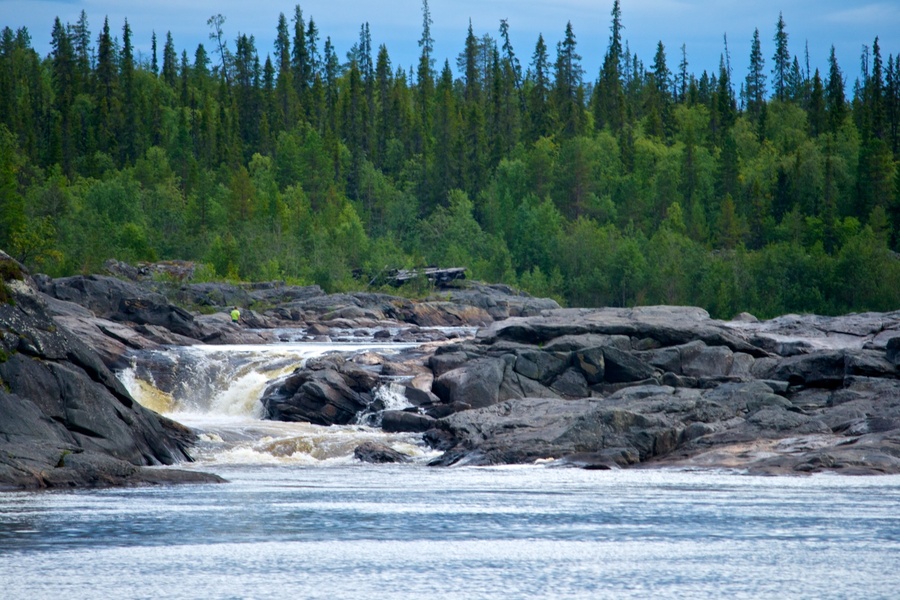
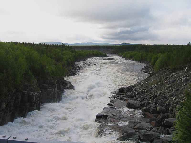
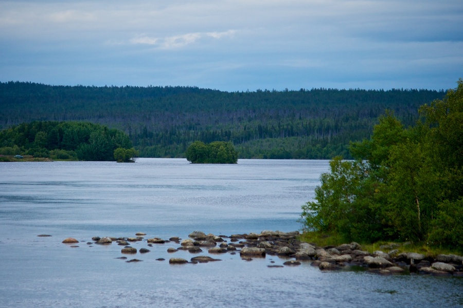
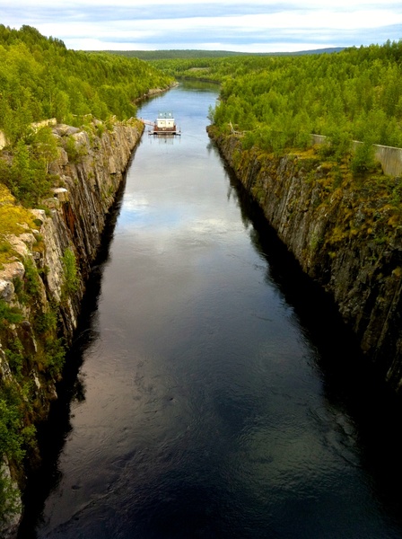
The Tuloma River starts out of the Nota Lake, about 65 km WSW from the town of Lezhashi. Its breadth near the Nota Lake is 18300 cm (183m) and just 6.5 kmfrom the town it grows as wide as 1098m; at the very mouth it is no more than 164m; this is why the currents are very strong and the water does not even freeze in very frosty weather conditions. The River’s depth near the town is 11-13m, and further it goes shallower with depth at the outfall not exceeding 3 m. The Siya River has many islands and rapids. The Siya islands are low and are abundant in hay-harvest, which is used by the residents of Kola. The most significant rapids of Siya: 1- just 12km from the town, having no bare rock; it is called Murmash; its depth is up to 8 feet. 2 – Sukhoi, just 18km from the town; has many rocks; wherein the straits are no more than 4 feet deep. 3 – Kalepukha is just 5km from Sukhoi. 4 – Sosnovets is just 5km from Kalepukha and expands to around 3 km and; 5- Krivets is just 30 km from the town and is the most ferocious and dangerous of all the rapids. 6 – Shovsky Corgi is just 15km from Krivets. 7 – Padun, where the river, just 5km from its outfall, takes a vertical drop of about 20 feet. There are a few smaller tributaries of the Tuloma River, among which the Shova River is the most prominent, which is 50km from the town of Kola. The tide only reaches to the first of the Tuloma rapids and is very weakly noticeable. This river’s banks, about 12km from the town, have quite tall rocky hills, which are covered with white moss, called the reindeer moss and thin birch forest. Further away to the top of the hills and shallows you can see large birch and pine forests, especially along the River Shovna, which has timber good for construction. Although the passage through the rapids is very difficult, but the Lapps supply the town with ample quantities of timber for making houses and boats.
Raineke M. F. Write-up of the town of Kola in the Russian Lapland – St Petersburg: the N. Grech publishing, 1830 – 58 pages.
“The Russian Lapland and the Russian Lapps”

The Tuloma waterfall… “I have seen many waterfalls – says famous traveller A. V. Elyseev – but none mesmerised me as did the Tuloma waterfall. Neither the Imatra, nor the Trolgetta, or even the mighty Kivach, not to mention the world renowned waterfalls like the Schaffhausen and Staubbach, can none compete with it. The likes of Tuloma falls can only be found among the waterfalls of the North America and Zambezi. A number of lakes on the Tuloma’s path offer tremendous trips only if not interrupted by rapids. The most popular of those are Krivets and Sukhon, which, in comparison with Tuloma, I would had compared with the renowned rapids of the Nile. The rocks along the Tuloma are everywhere and are so closely placed that at places there is not passage except for the birds. The strong currents at such spots raise mountains of water and initiate a number of whirlpools (eddies), which interrupt the Tuloma channel for miles and miles around”.
Actually the Tuloma basin offers some of the most scenic spots in the whole of Lapland. “A person, who would accidentally come to this place – says an eyewitness – would not believe that he was in the extreme north, in the Archangelsk governorate. The whole land, the beautiful rocky hills, scenic, green islands, unexpected turns of the river with its rapids and especially the richness and variety of plantation, mesmerise everyone”…
The Tuloma River


Current weather
| Ristikent | Nivankyul |
|---|---|
Sunny | Mostly sunny |
| Temperature: 7° | Temperature: 3°C |
| Comfort: 9°C | Comfort: 8°C |
| Humidity: 73°C | Humidity: 80°C |
| Wind direction: SSW | Wind direction: CLM |
| Wind: 1 m/sec. | Wind: 0 m/sec. |
| Pressure: : 1020 hPa | Pressure: : 1020 hPa |
Site map
Address
Murmansk region, 72nd km Highway P12 Kola-Lottainfo@ristikent.ruDriving directions
Copyright © 2025 Ristikent


